

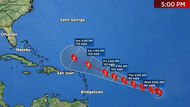
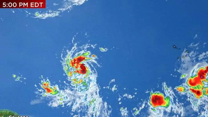
We could see one for the ages in terms of how fast newly-named Tropical Storm Lee strengthens. The intensity isn’t in question. It’s the track. It continues to look likely that Lee is not coming to Florida, but that is far from set in stone.
Recommended Videos
The steering current upstream in Canada and the Northwest U.S. is complex and volatile to say the least and questions remain just how strong or weak the Bermuda High driving Lee west will be by the time it passes north of the Caribbean islands by this weekend.
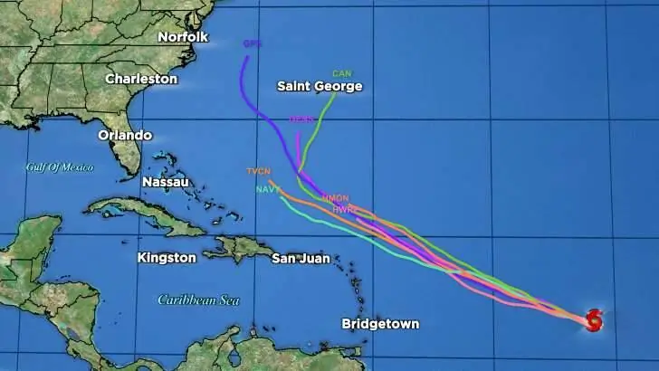
Any subtle changes in how these features come into fruition from what is currently being modeled can have big impacts on the eventual path of Lee. This is still just something to watch, knowing that for now, Lee coming to Florida is on the lower end of probabilities.
We’ll talk soon!
Any questions...shoot me an e-mail!
- Jonathan
Hurricane season is officially underway and the Pinpoint Weather Team at News 6 will be here for you. We want to make sure you stay updated on the tropics and all things weather, of course.
If you’re new to the Tropics Watch Newsletter, thank you for signing up! I will be visiting your inbox every Monday (and as needed) to talk all things tropics this hurricane season. We also have a live tropics show that airs on our YouTube channel every Monday at 11 a.m.
Hopefully, we can break down the science and meteorology of these storms as they stay WAY out at sea.
Obviously, last year was rough. This isn’t a time to stress out or be anxious but to simply be prepared. Most of the time Central Florida doesn’t get hit, but typically there’s a lot going on in the Atlantic Basin as we get deeper into the summer.
That’s where the Pinpoint Weather Team comes in. We will remove all the noise that is out there and tell it like it is.
The Tropics Watch newsletter works a little differently than our other newsletters you may be subscribed to at News 6. This is going to come out after Monday afternoon to keep you posted on what could happen, but I will also visit your inbox if something “pops.”
When a new storm is born, the track or intensity changes, another area to watch develops or just something interesting is going on in the tropics, you will know about it. It’s my hope that we can have a conversation about the science and meteorology involved in tropical weather forecasting.
If you have any questions or concerns about anything weather related, please reach out. My email is jkegges@wkmg.com. If there is something you would like to be added to this newsletter or a topic you would like covered, let me know.
Talk to you soon! Well, hopefully not that soon.
