ORLANDO, Fla.- – The area of disturbed weather near the Bahamas is now Potential Tropical Cyclone 9. This disturbance is expected to become Tropical Storm Humberto as it moves toward Florida this weekend.
While there is not a circulation for this disturbance to be considered a depression or a tropical storm yet, this area of low pressure has been given the potential tropical cyclone label.
The National Hurricane Center does this so that its forecast cone can be released and watches/warnings issued if necessary. This typically happens when development is likely when unorganized storms are close to land.
Watches and warnings:
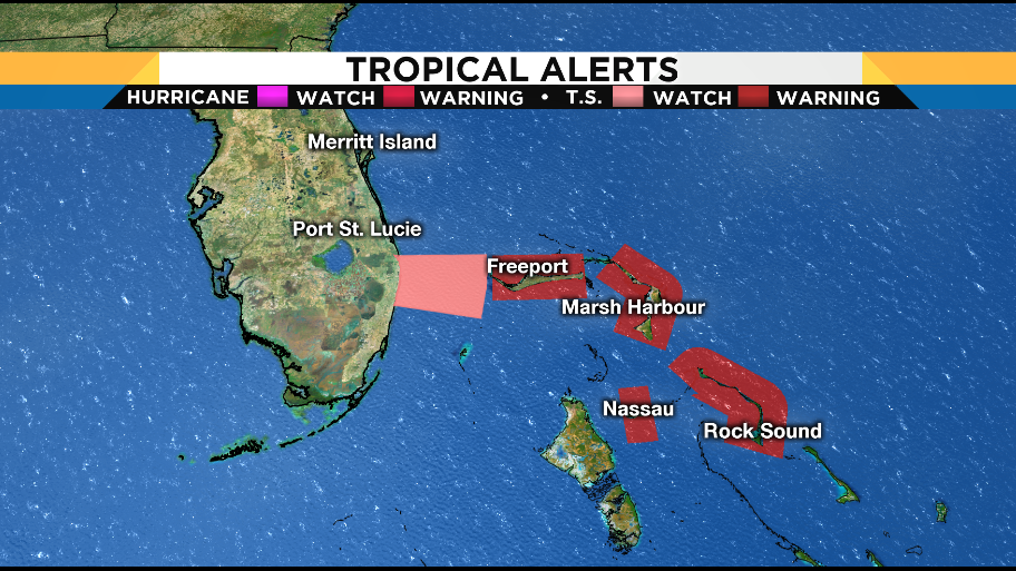
A Tropical Storm Watch has been issued for portions of Florida.
A tropical storm watch is in effect for Jupiter Inlet to Volusia-Brevard County line
Uncertainty is high as to where PTC #9 goes due to the fact the center of the storm has yet to develop. Once that happens, much more confidence will be had.
Central Florida impacts:
Rain chances increase for the weekend no matter where this disturbance goes. If it moves over Florida, that rain could be heavy at times.